


Siem Reap’s Stonehenge: The Temple Hidden in Plain Sight
SIEM REAP — Down a web of narrow village roads, past wooden stilt houses and fields edged with palms, a 1,000-year-old temple sits quietly beneath a dense bamboo canopy.
Most travelers pass nearby without ever knowing it’s there. Those who do find it tend to stop in their tracks.
Weathered, fragmented, and half-reclaimed by forest, the temple of Totoeng Thngai feels less like a monument and more like a secret—one that rewards curiosity with stillness, mystery, and a rare sense of intimacy with Cambodia’s early sacred landscape.
Its crumbling form invites questions. Its hidden setting sparks a small thrill of discovery. And its natural embrace hints at a time when this peaceful countryside belonged to Hariharalaya, the early Khmer capital named for the divine union of Hari and Hara.
Most visitors know Angkor Archaeological Park for its soaring stone towers and grand causeways. From the 9th to the 15th centuries, Angkor was the political and spiritual heart of the Khmer Empire, producing some of Southeast Asia’s most ambitious architecture.
When the empire waned and populations shifted, many temples were left to nature for centuries. Angkor’s rediscovery and its inscription as a UNESCO World Heritage Site in 1992 brought global attention—but mostly to the biggest, most accessible monuments. Smaller temples, tucked deep into villages and forests, remained largely overlooked.
Totoeng Thngai is one of them.
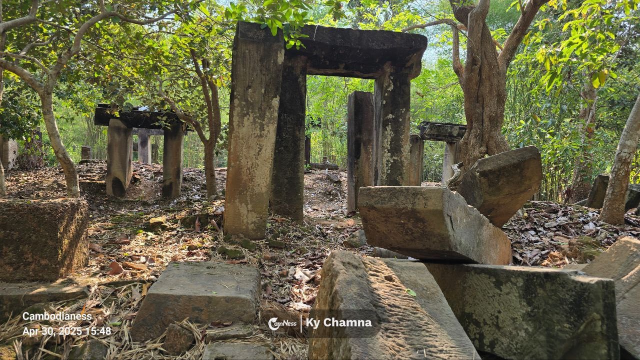
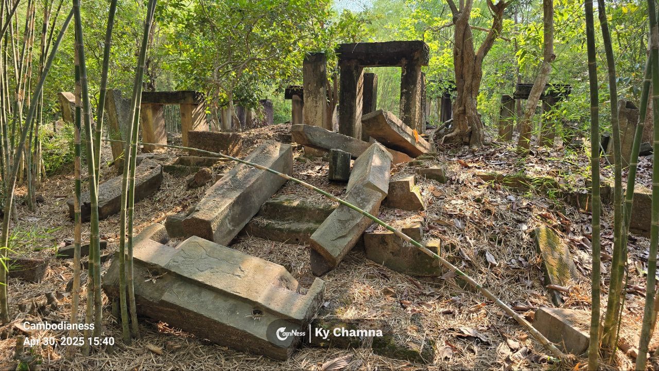
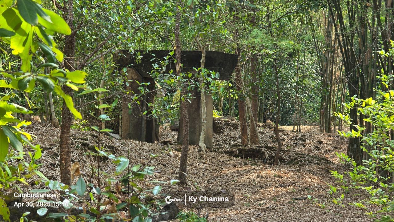
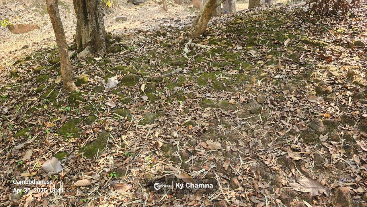
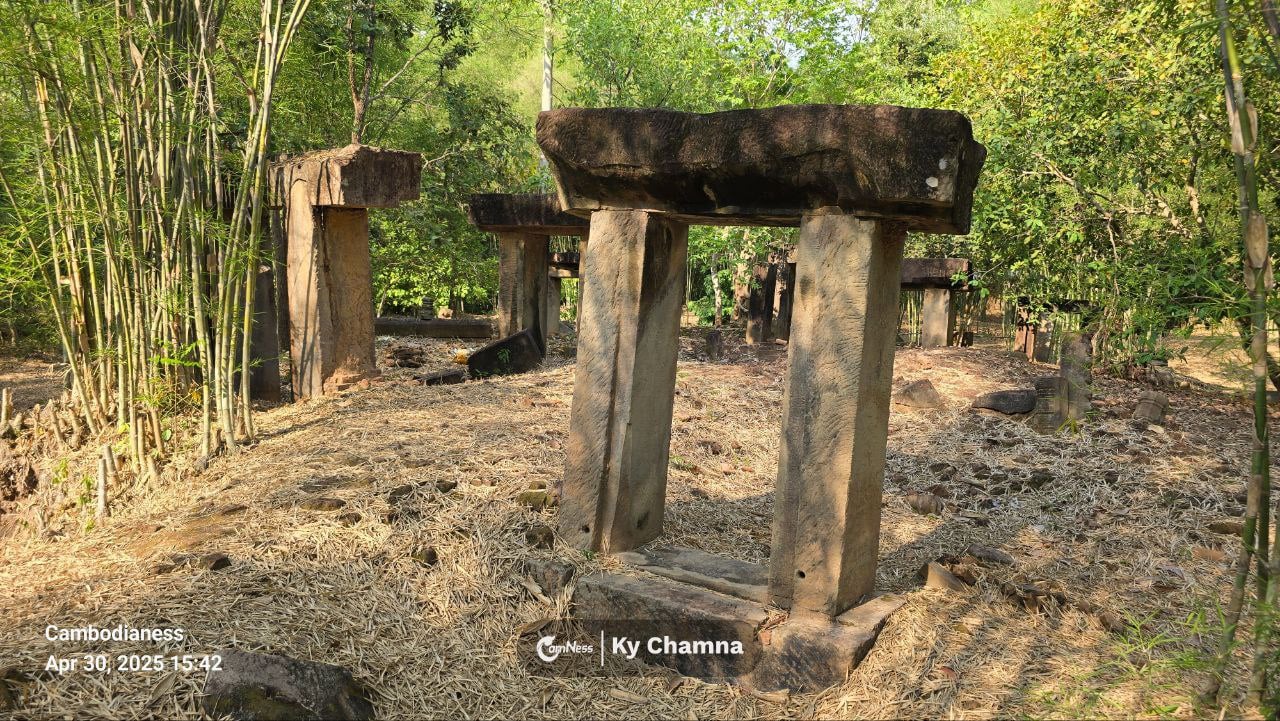
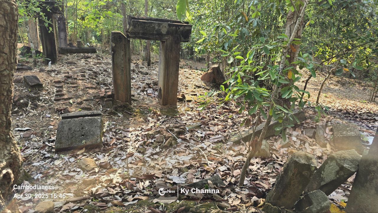
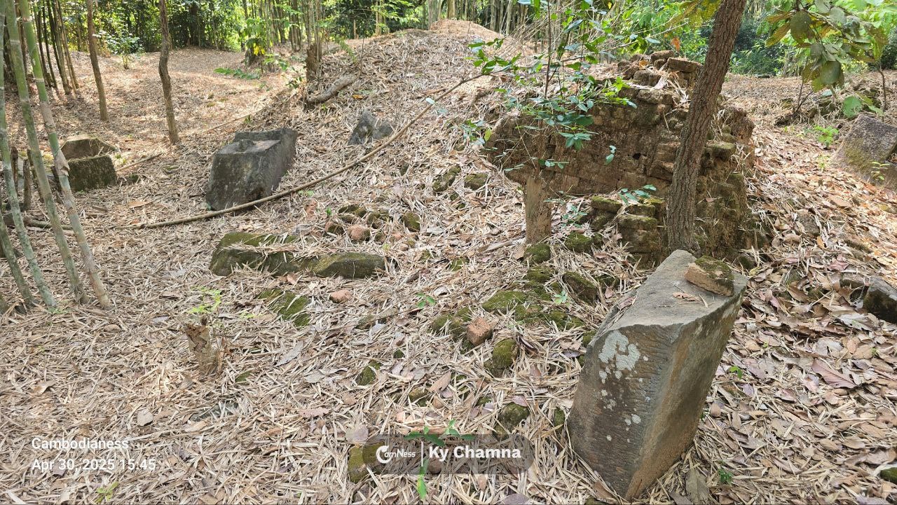
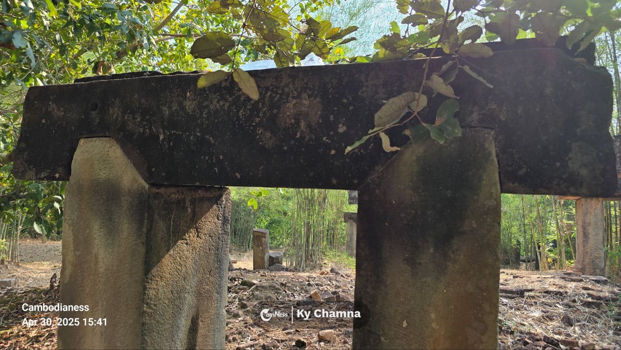
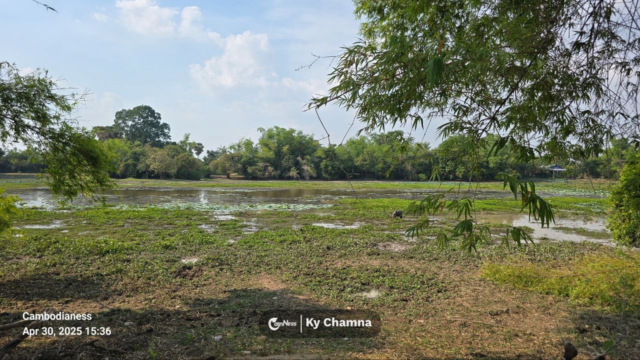
Like many temples of its era, Totoeng Thngai was built primarily of brick, with sandstone reserved for door frames, colonnettes, lintels, and pedestals that once supported sacred statues. Time has not been gentle. Much of the brickwork has collapsed into scattered mounds, slowly swallowed by bamboo and leaf litter.
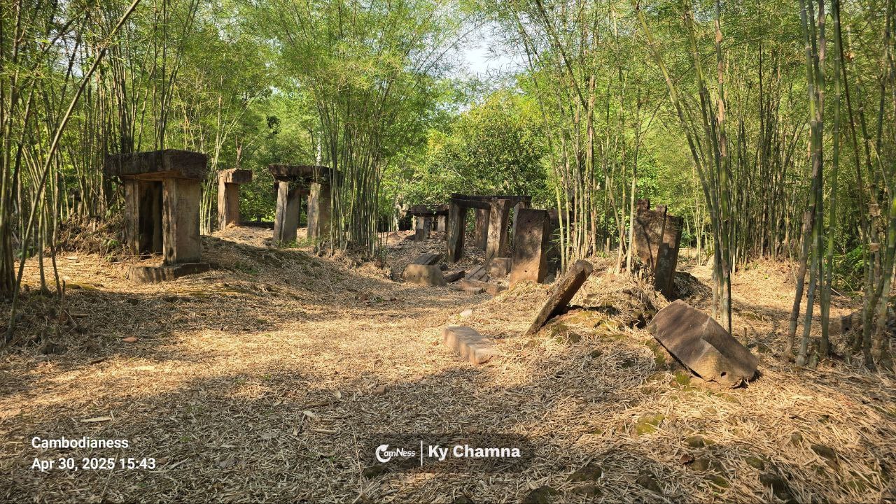
What remains are a handful of upright sandstone frames—silent markers that hint at former shrines and pathways. Standing among them, the site evokes an uncanny resemblance to Stonehenge: fragments aligned just enough to suggest order, ritual, and long-lost purpose.
Brick temples like this are especially vulnerable. Roots coil and press against foundations, leaves bury lower walls, and brittle bricks resist restoration far more than solid stone. Over time, nature doesn’t just surround the structure—it reshapes it.
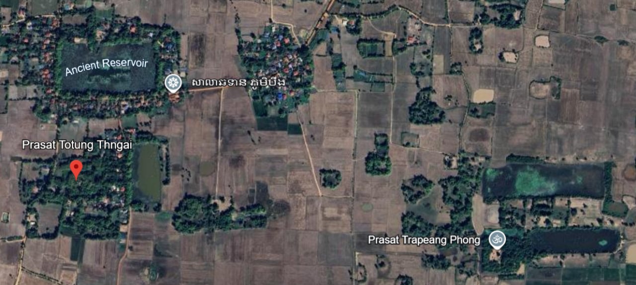
A 1946 plan by researchers from the École française d’Extrême-Orient shows that the temple once had a rectangular enclosure wall with an entrance aligned to one of the cardinal directions. Inside, nine shrines stood in a precise geometric layout. Today, traces of the wall remain barely visible at ground level, softened by sediment and grass.
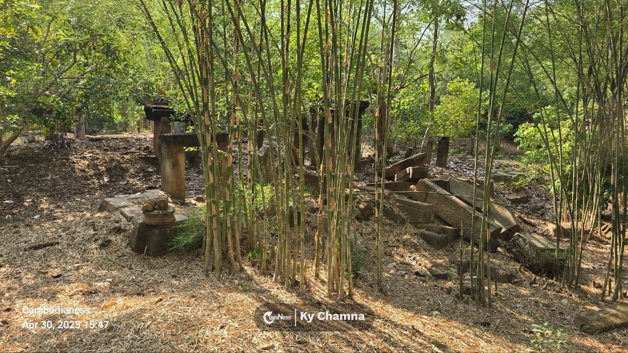
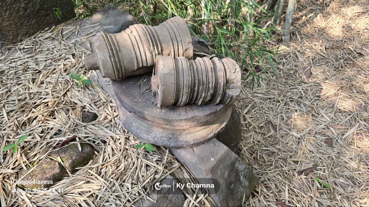
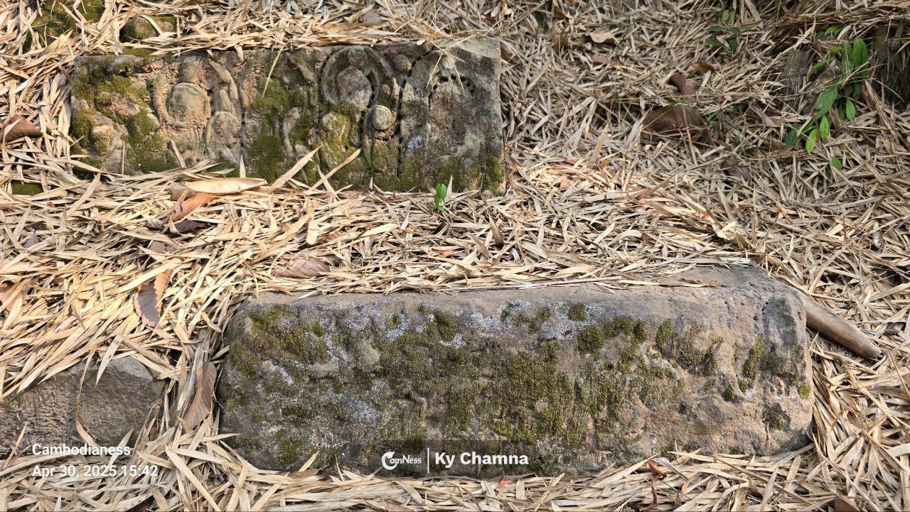
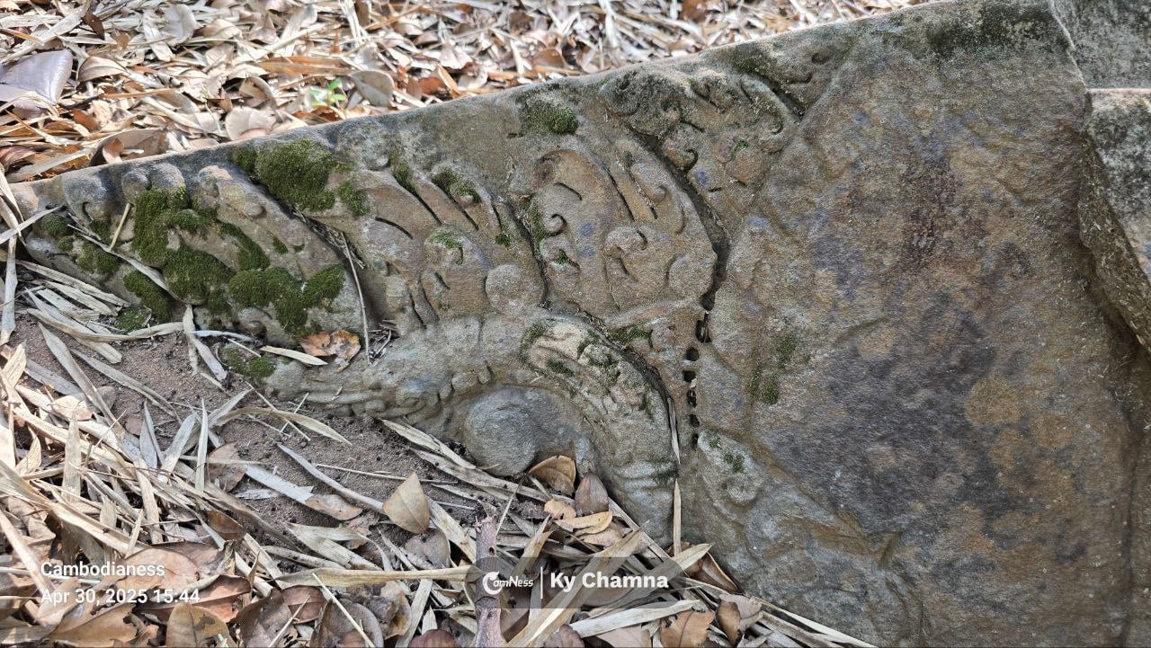
Scattered across the site, visitors can still spot sculpted pedestals, colonnettes, and partially buried lintels—small details that reward slow looking.
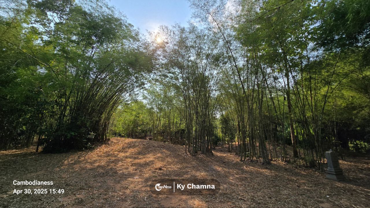
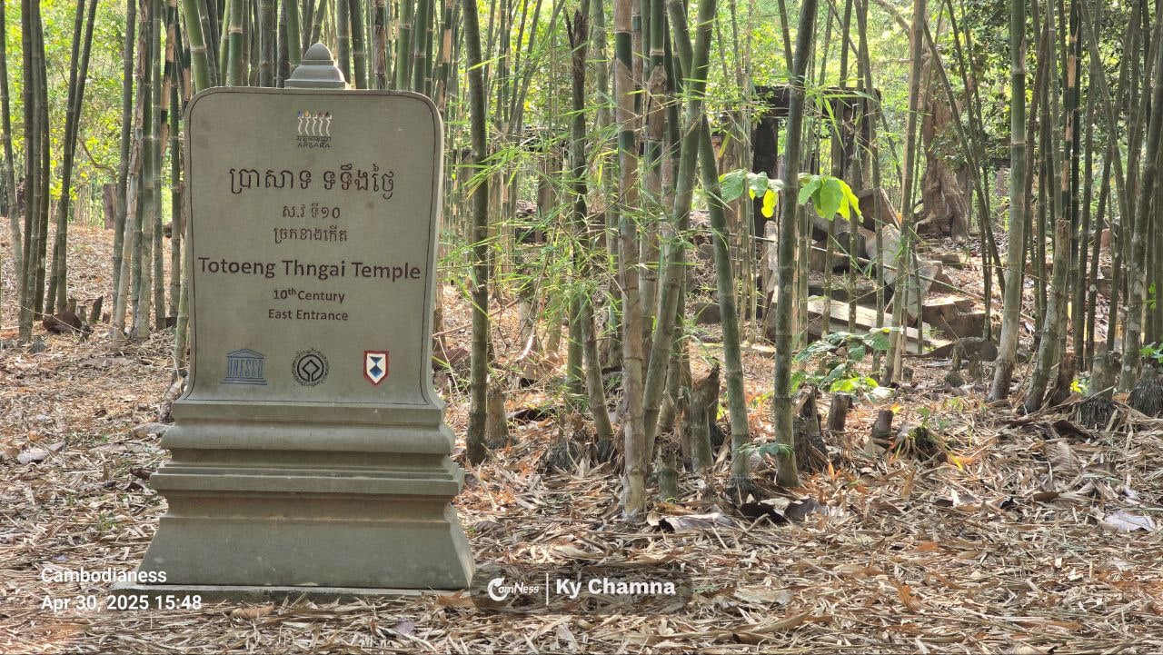
In 2014, Google Street View showed the temple nearly lost beneath vegetation. Since then, local heritage authorities have carefully cleared access paths, making it far easier for curious explorers to reach. At the eastern approach, a modern stone stele marks the site, bearing the emblems of UNESCO and the Blue Shield—symbols that underscore its protected cultural status.
Fifteen Kilometers, Two Different Worlds
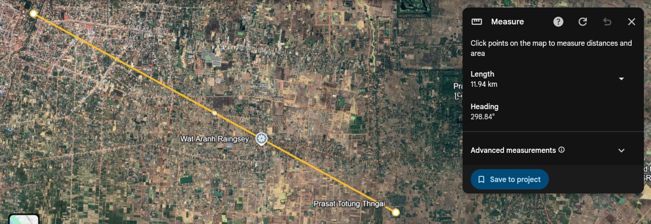
One of Totoeng Thngai’s quiet surprises is how close it is. Just 15 kilometers from Siem Reap’s city center—and only 2.5 kilometers from National Road 6—the temple feels remote without truly being so.
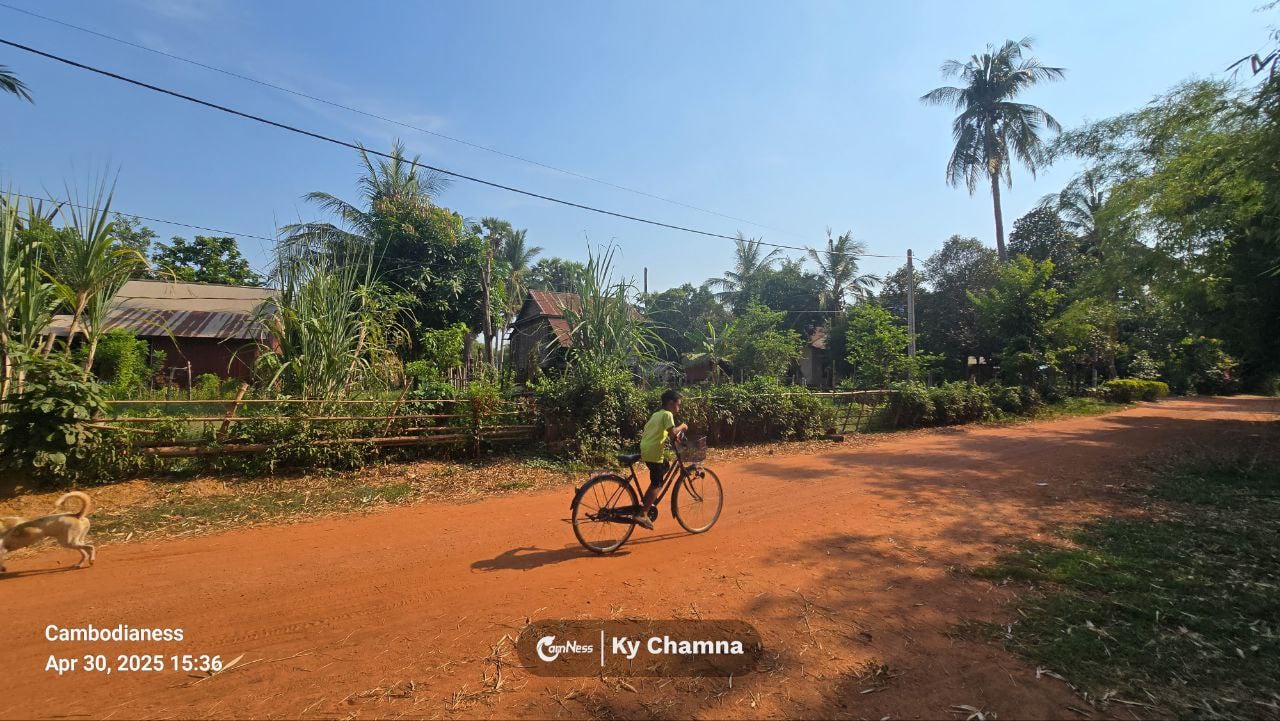
A half-hour drive carries you from cafés and hotels into a living rural landscape. Rice paddies stretch toward the horizon. Cattle graze in the dry season; bright green shoots ripple in the monsoon. Children cycle to school. Elders fish, farm, chant, and watch over grandchildren from shaded verandas. Dogs patrol dusty lanes like unofficial village guardians.
Reaching the temple is straightforward by car or motorbike, though caution helps during the rainy season when village roads turn slick and muddy. Planning ahead is wise—the winding communal roads can be disorienting, and mobile internet can be patchy.
For those eager to wander further off the beaten path, the area also holds lesser-known sites such as O’Kaek, Srangae, North and South Kandoal Doeum, Ov Lok, Svay Pream, and Trapeang Phong—quiet ruins that rarely see crowds.
Why Totoeng Thngai Matters
For history lovers, Totoeng Thngai offers something rare: a chance to understand Angkor not just as a collection of famous temples, but as a living landscape shaped over centuries. While Bakong dates to the 9th century, several nearby temples are believed to be even older—pre-Angkorian foundations that reveal how sacred geography evolved alongside power.
Here, it becomes easier to see how temples related to rivers, reservoirs, and natural terrain—and how early planners laid the groundwork for what Angkor would later become.
Depending on the route taken, non-local visitors may need an Angkor Pass, as the site falls under the administration of the APSARA National Authority. What you gain in return is not spectacle, but something quieter and arguably more memorable: the feeling of standing alone with history, bamboo whispering overhead, in a place most people never think to look.
Locate this temple on Google Maps, or by using the coordinates below:
https://maps.app.goo.gl/qAceGnpb3xV9BZZVA
13.311125194435444, 103.95638695164078
Source: Cambodianess